Monday, October 1, 2012

A sweet adventure

With a rare Sunday sans football, John and I decided to make it special. We woke up early, went out to breakfast (Pancake Mill!), and drove past Florence to this great little web of hiking trails. We discovered them with the South Coast Striders many months ago, and I wanted to go back, just us, for more exploring.

We stopped off a Beaver Creek Falls first (and for some reason, my photos loaded out of order a bit, so there's another photo of Beaver Creek Falls later).

If you climb out onto this huge tree that fell across the creek, you get a great vantage point. The view was worth the bushwhacking we had to do to get here — the trail was a bit overgrown.


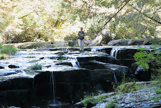
Then we drove down to the Homestead trailhead of Sweet Creek Falls, which takes you through this gorgeous canyon for about a mile, ending at Sweet Creek Falls itself. The last time we were there, the water flow was much higher, as it was late spring. Right now, the creek had to deal with a very dry summer, and will soon be up and at 'em. 

Low water flow, we discovered allowed us to sneak down by the creek and wander around much more.


More mini waterfalls along the way.


This stop off was my favorite little side excursion. There were three waterfall tiers (which I couldn't quite get into one photo, as the lower one was quite a bit lower), and how beautiful is this? We were right on the water after a little climbing off the trail.


Here's the random photo of Beaver Creek Falls that got stuck in the middle. Ha.


And back to the off-trail excursion. We found this crawdad wandering about aimlessly. We watched him for about five minutes as he decided where he should re-enter the water — it's a treacherous area for such a little guy, and he eventually (and cautiously) tumbled into a pool.


Here's the lower portion of Sweet Creek Falls. There's a small trail that leads you to the upper viewpoint and upper tier of the falls, but it's running awfully low this time of year, so no photo of that. But this little area was quite pretty. We sat on some rocks in a quiet pool of water right below the falls; this area hadn't been touched by the hot sun, so it cooled us off from the 70-plus-degree day.


And here are a few more photos on the hike back, when the light was better to capture all the beautiful falls along the way. A few of these looks quite impressive with higher water flow, but look delicate at summer's end.


Thursday, May 17, 2012

Missing the Gorge

Though I only lived in the Columbia River Gorge for about two months, I miss it. A lot. And I didn't realize that until we took a trip to Portland, saw Mt. Hood, Mt. Adams and Mt. St. Helens looming on the skyline, covered in snow.

Then we drove to the waterfall-laden part of the gorge, and I just wanted to set up camp and stay there forever. In case anyone wants to save up now for my Christmas present, you're welcome to buy me one of those cute little homes along the Historic Columbia River Highway — there were plenty of them for sale. 

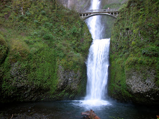
Here's Multnomah Falls — everyone's seen it, but it's still nice to visit. And best to visit before 10 a.m., when things are still quiet.


Here's a waterfall that somehow had escaped me after all these years and visits to the gorge — Latourell Falls. It was easily seen from the parking lot, but was even better when you walked up to it. And you really could walk right up to it, gaze straight up and feel the mist.


A little perspective, since it's difficult to see just how high this falls is: Here's John taking in the misty coolness of Latourell Falls.


The view across the gorge. How amazing would it be to live RIGHT THERE?


Then we stopped at the Vista House, mostly because John hadn't been there and also because I'd never been inside. It's incredibly beautiful!


Of course, the beauty of the view from the Vista House is really why people are there. Sigh.


Thursday, February 16, 2012

A caving we will go

Also with Wanderlust Tours, we went caving. I guess it was more like "lava tubing," but that's difficult to say.

We drove to Boyd Cave, which is the only one they visit in winter, though they do lots more in the summer. There was a wet fog the night before, and it blanketed the high desert with hoarfrost that was just mesmerizing. Bend's diversity in landscape is amazing, since it's nestled right between high desert and mountains — never a dull moment when you're driving around.

So since the cave was in total darkness, we had to wear headlamps on our helmets (which also means there's basically no photos from inside). We saw a couple hibernating bats inside while we learned about the volcanic history of the region. I love volcanoes.

So anyway, here are some pictures of the hoarfrost-covered vegetation on a cold winter morning.


After we returned from the end of the cave, we were greeted by this view of the cave opening. There's some metal, rickety stairs off to the right, but this view lets us see it without the manmade structures, and it looks pretty mysterious, doesn't it?


Though it was warmer and sunnier by the time we emerged, there was still frost all over most of the plants. It felt soft like snow, if you can believe it. It looks so harsh.


And us, the intrepid cavers! Photo courtesy of our guide, Jeff, who was a geologist and knew SO MUCH about caves, and volcanoes and local wildlife. Notice the intense amount of dust on my pants, thanks to crawling around on our hands and knees. Ha.


That afternoon we visited the High Desert Museum, which was honestly one of the best museums I've ever visited. It was newly renovated, beautifully-done and so interesting. Plus they had birds of prey, which are totally some of my favorite animals out there. I could have watched that golden eagle and red-tailed hawk all day. We spent about 2 hours there, despite everyone saying it was a "small" museum — and it only cost $10 for adults to get in, which truly shocked me. Museums have gotten quite expensive these days, and this seemed like a steal.

The next day we just wandered around the downtown area (which had lots of restaurants and shops), then toured Deschutes Brewery (it was FREE and included samples)! Deschutes makes our favorite beers, from pale ales to IPAs to imperial stouts, and the brewery was so scientific and fascinating. It was huge, first of all, considering it's a micro brewery (albeit one that ships to half the U.S.). Equipment was everywhere, looking all shiny and sterilized, most people working there were guys (on the floor at least, as the tour guide said one of the women who worked there was just upgraded to a master brewer), and it was humming much faster than that opening credit footage on "Laverne and Shirley." It smelled a faint but delicious cross of bread and beer.

They reuse all of their hops, wheat, grain, etc. that are used in crafting the beer. When we ate at Deschutes Brewery the night before, the incredible pretzel we had as an appetizer was made from leftover grains, as were the burger buns. Pretty cool stuff. They're slowly taking over the world, and I'm OK with that.

Sunday, February 12, 2012

Snowshoeing in paradise

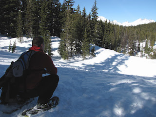
On Monday morning, we went snowshoeing with Wanderlust Tours at the base of Mount Bachelor. We figured since we didn't know how to snowshoe (or even how to put them on correctly), going with professionals would be best.

Plus, they take you off trail and into the woods — which is hard work since the snow isn't packed down, but super nice because it's free of snowmobiles, cross country skiers and other snowshoers. Perfect silence (save for our click-clacking snowshoes).


Our guide, Chase, is on the left, talking with one of the guys in our group. I think he was teaching us that we could eat certain lichens if you get lost in the woods. They actually didn't taste bad, they just felt like eating hair!


Here's Chase being annoyed by the kid. But I think he was showing us what a Ponderosa pine looked like.


We got near the end of our excursion and it opened up to this view of the Three Sisters mountains. It actually took our breath away, it was that beautiful (but we also didn't have much air up there at 6,400 feet, so perhaps that was part of it).


Looking back on our now-packed trail:


The shadows of the trees shaded us a bit, but here's a heavily doctored photo of me and John, taken graciously by Chase. Yep, we were sweaty and hot in that getup, even after we lost the winter coats and gloves.


There's a company that runs dogsled tours at Mount Bachelor, too. We could hear them barking, ready to go for a run, right before we started. It's expensive, I think, but how cool would that be? The other family in our group did it a couple days before and said it was incredible.


Just a cool photo. Chase was teaching us that the Three Sisters are actually called Faith, Hope and Charity (but what a mouthful that is!), and that Mount Bachelor used to be called Brother Jonathan in reference to their names. Then it was changed to Bachelor Butte (butte is a popular name out here around these volcanic areas, and is probably more accurate), but Chase said nobody wants to ski and snowboard on a butte. So they changed the name to Mount Bachelor, mostly for commercial purposes!

There's a pair of restaurants in town, English-type pubs, that go by the name Brother Jon's in reference to Mount Bachelor's old name. Anyway, there's your history lesson for the day.


After the trip, we ate some Vietnamese food and passed out for about 40 minutes, we were that worn out by snowshoeing. We took the hottest showers ever to soothe our sore muscles (snowshoeing does wonders for your thighs) before we ate at 10 Barrel Brewing Company for dinner. I think it's my new favorite place — their burger and mac and cheese were incredible, plus they had an awesome vanilla porter on nitro tap that hit the spot right before dessert, which was lemon custard for John and peanut butter mousse (but it was really more of a cheesecake consistency) for me.

Just another day in paradise.

Saturday, February 11, 2012

Discovering Bend

Our vacation to Bend was so incredible that I literally didn't want to leave. That happens often with vacations, but this time, I actually wanted to move there. And still do. If we could find work, we'd be packing tomorrow.

Our hotel was right along the Deschutes River, and we ate breakfast (and had a fantastic dinner at their steakhouse the first night) right by the river. It was beautiful.

A short jaunt from our hotel:


And a shot of the bridge at our hotel and the hotel on the right — told you it was right on the river.


To wake up our low-lander lungs, we hit Pilot Butte for a hike on Sunday. It's very popular because of its great, short hike (there were a lot of locals just exercising), and well, the view at the top.

This shot exists basically because we were masking the need to take a break. Nothing like a hike to expose the fact that you don't live above sea level. These are some mountains in Eastern Oregon, and some residential areas of Bend (Pilot Butte is a cinder cone that's right in the middle of town).


Further up, we spotted Mount Hood up by Portland. Quite a few hours away, and it still dominates the skyline. What a mountain.


And the true reason for Pilot Butte — the incredible view of the closer Cascade Mountains. On the left is Mount Bachelor (which we'll be visiting later), the middle mountains are the Three Sisters, and the one on the right that looks like multiple mountains is Broken Top.


A better view of the Three Sisters and Broken Top:


And Mount Bachelor:


This guy is the reason Pilot Butte was saved for a state park, and it's a really nice one. Bricked platform at the top, bathrooms and handicapped people can even drive up there. Click on this one so you can read it though — it's pretty funny, which is why there's a photo to begin with.


Looking east again — no idea what the mountains are out there because there are just so many and they kind of look the same from such a distance:


Pilot Butte also has great benches (or I guess one giant bench in a circle) to sit and take in the view, so that's exactly what we did. Breathing in the mountain air on a day like that was invigorating — I had missed that.


Up close of Broken Top — pretty spectacular, isn't it?


And here's a compass that listed all the mountains (and buttes, which can kind of be more like large hills) that were visible in a 360-degree view:


Needless to say, I wanted to buy a house at the base of Pilot Butte and never leave. I could walk this every day and never get tired of that view. But there's plenty more exploring to come!